File:ResolutionFOMlinscale.png
Jump to navigation
Jump to search
No higher resolution available.
ResolutionFOMlinscale.png (785 × 451 pixels, file size: 60 KB, MIME type: image/png)
Summary
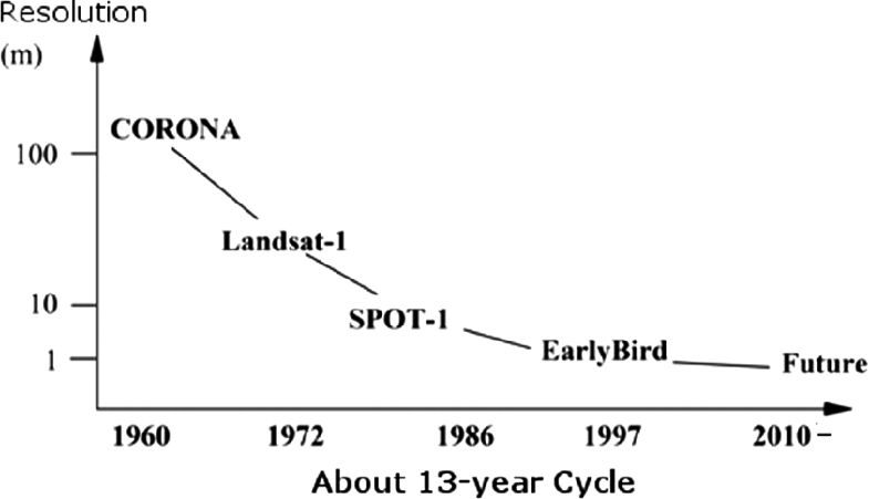
Improvements to satellite imaging resolution over time on a linear scale.
File history
Click on a date/time to view the file as it appeared at that time.
| Date/Time | Thumbnail | Dimensions | User | Comment | |
|---|---|---|---|---|---|
| current | 05:16, 1 October 2020 | | 785 × 451 (60 KB) | Cbullock (talk | contribs) | Improvements to satellite imaging resolution over time on a linear scale. |
You cannot overwrite this file.
File usage
The following 2 pages use this file: