Difference between revisions of "Earth Observation Satellites"
| Line 19: | Line 19: | ||
[[File:RemoteSensingSatelliteV3.jpg]] | [[File:RemoteSensingSatelliteV3.jpg]] | ||
[[File:RemoteSensingSatelliteImagingPayloadV3.jpg]] | [[File:RemoteSensingSatelliteImagingPayloadV3.jpg|100px]] | ||
==Figures of Merit (FOMs)== | ==Figures of Merit (FOMs)== | ||
Revision as of 05:01, 1 October 2020
Technology Roadmap Sections and Deliverables
Roadmap Overview
Design Structure Matrix (DSM) Allocation
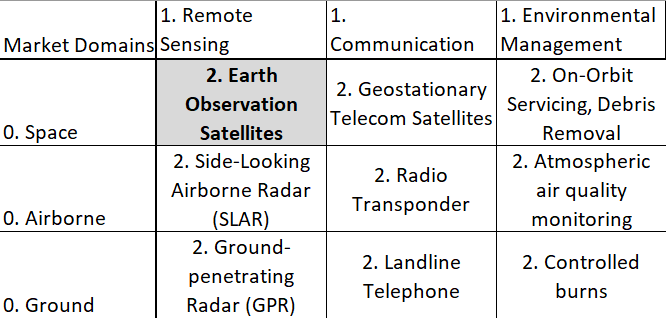
We have designated Earth Observation Satellites (2EOS) as a Level-2 Technology. It is present in the Level 1 Markets of 1) Low-Earth Orbital Technologies and Remote Sensing Technologies. For other examples of intersections on the basis of these markets, see the following figure:
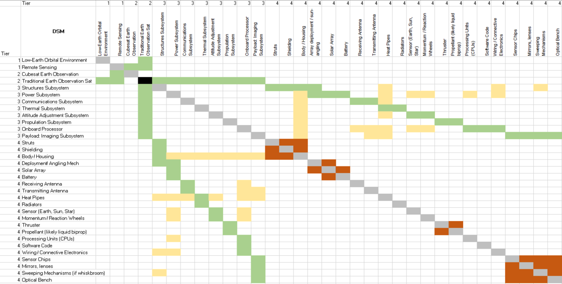
Our Design Structure Matrix (DSM) is as follows:
Legend: Green: Direct Component (solar arrays are a component of the Power Subsystem) Yellow: Cross-relationships between technologies and other subsystems (heat pipes interact with all other subsystems to transfer heat) Orange: Physical interactions between Level four technologies within the same subsystem (solar arrays interact with any deployment and angling mechanisms)
Roadmap Model using OPM
Our Object Process Diagram (OPD) is pictured below, complete with a Level Zoom to examine components of the Imaging Subsystem.


